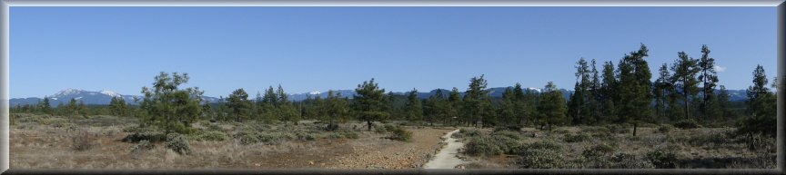


| Forest: Rogue River-Siskiyou National Forest with the Medford District Bureau of Land Management (BLM) and the State of Oregon District: Wild Rivers Ranger District Description: Soils at Rough and Ready flat consist of ultramafic alluvial deposits from Rough and Ready Creek. The ultramafic deposits have led to serpentine soil conditions favoring a unique plant community which is sparse and desert like in appearance. Rising above the flat are knob like hills characterized by non-serpentine soils where dense Douglas-fir forests, typical of the Pacific Northwest, flourish. The flat provides an excellent place to observe the strong effect soil type has on vegetation. People are typically surprised to learn that although desert like in appearance, the flat receives 60-70 inches annual precipitation. Viewing Information: The botanical site consists of a 19 acre Oregon State Park, an 1,164 acre BLM Area of Critical Environmental Concern and a 1,560 acre U.S. Forest Service Botanical Area. A rocked trail originates at the parking area, traverses the state park and leads to Rough and Ready Creek on BLM land. The majority of the area lacks designated trails and can be explored by foot travel only. Visit Cave Junction.com for a list of wildflower species and approximate bloom time. Safety First: The rocky terrain mostly lacks trails, thus adequate foot and ankle protection should be worn. Rattlesnakes may be present during much of the year. Summer temperatures often exceed 100 degrees Fahrenheit and no drinking water is available on site. Directions: Rough and Ready Botanical State Park Wayside is located about 4.5 miles south of Cave Junction, Oregon along highway 199. Parking is available on the west side of the highway. The pull-out features a trailhead, a covered picnic table and a kiosk with botanical interpretation. For more information contact Rogue River-Siskiyou National Forest. Ownership and Management: U.S. Forest Service, Rogue River-Siskiyou National Forest; USDI Bureau of Land Management, Medford District BLM; and, State of Oregon Parks Department. Closest Towns: O'brien, Oregon, 1.5 miles south; and, Cave Junction, Oregon, 4.5 miles north. Source: US Forest Service |